When planning a land development project, one of the most critical steps developers often overlook is conducting a boundary survey before finalizing subdivision plans. For those working on subdivision surveys in Edmonton, understanding the precise boundaries of the property is essential. Skipping this process can lead to costly mistakes, legal disputes, and delays that could derail the entire project.
Why Boundary Surveys Matter in Subdivision Planning
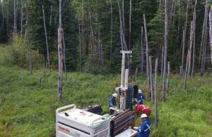
A boundary survey determines the exact legal limits of a property. It involves measuring and mapping the land using specialized equipment and verifying property lines against legal descriptions and historical records.
For developers, this information forms the foundation of the entire subdivision process. Without an accurate understanding of the property’s boundaries, you risk:
- Encroachment issues – Building on land that doesn’t belong to you.
- Legal disputes – Neighbours or municipalities challenging your subdivision plans.
- Delays in permits – Municipal authorities often require precise boundary data to approve subdivision projects.
In Edmonton, subdivision approvals require developers to submit detailed plans, and an accurate boundary survey ensures these plans comply with zoning regulations and land-use bylaws.
How Boundary Surveys Support Subdivision Surveys in Edmonton
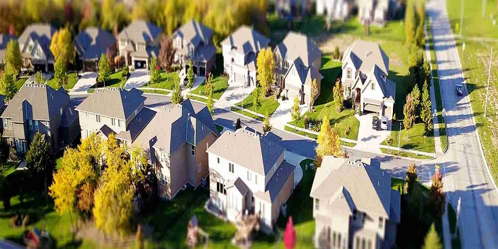
When preparing for subdivision surveys in Edmonton, boundary surveys provide a reliable starting point. Subdivision surveys involve dividing a parcel of land into smaller lots for residential, commercial, or industrial development.
However, before creating these new parcels, developers need to know exactly where one property begins and another ends. A boundary survey ensures:
- Accurate Lot Layouts – Subdivision plans rely on precise property lines to allocate land efficiently and legally.
- Compliance With Municipal Requirements – Edmonton’s land-use bylaws require exact measurements to prevent disputes and ensure proper infrastructure planning.
- Smooth Registration Process – Once subdivision surveys are completed, they need to be registered with the land titles office. Incorrect boundaries can cause significant delays during registration.
Without accurate boundary information, subdivision surveys risk being rejected, forcing developers to revise plans and spend more time and money.
The Risks of Skipping a Boundary Survey
Some developers attempt to cut costs by skipping boundary surveys and relying on outdated property maps or past surveys. While this may seem like a time-saver, it can lead to significant setbacks:
- Survey discrepancies – Older surveys may not account for changes in land use, road expansions, or updated municipal zoning requirements.
- Overlapping claims – Adjacent property owners may dispute your proposed subdivision boundaries, resulting in expensive legal battles.
- Project delays – Inaccurate boundary data can cause municipalities to reject your subdivision plans, forcing revisions that delay approvals.
Investing in an accurate boundary survey upfront prevents these complications and keeps your development on schedule.
Best Practices for Developers in Edmonton
If you’re planning a subdivision project, here are a few tips to ensure a smooth process:
- Get a boundary survey before drafting subdivision plans. This helps avoid redesigns and delays later.
- Work with professional land surveyors. Their expertise ensures that your subdivision surveys meet Edmonton’s strict municipal requirements.
- Review municipal zoning bylaws early. Understanding land-use regulations can save time when submitting plans for approval.
- Plan ahead for infrastructure. Accurate surveys help coordinate roads, utilities, and drainage systems within the subdivision.
For developers pursuing subdivision surveys in Edmonton, boundary surveys are not just an optional step — they’re a necessity. By ensuring accurate property lines from the start, you avoid costly disputes, streamline approvals, and set your project up for success.
For More Information About Survey Real Property Reports Saskatchewan and Survey Real Property Reports Regina Please Visit: CORE Geomatics.