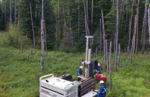
Surveyors in Alberta play a fundamental role in defining and managing land ownership across the province. From residential properties to large scale developments, clear and accurate boundary information is essential for avoiding disputes and supporting confident decision making. Their work provides the foundation for understanding where one property ends and another begins, which is a critical aspect of land management in both urban and rural settings.
Establishing Clear Property Boundaries
One of the primary responsibilities of surveyors in Alberta is to determine and confirm property boundaries. Using precise measurements along with historical land records, they establish legal limits that define ownership. This process ensures that landowners have a clear and reliable understanding of their property and how it relates to surrounding parcels.
Accurate boundary identification becomes especially important in situations where visible markers such as fences, walls, or natural features may not reflect legal property lines. Over time, these markers can shift or be placed incorrectly, leading to confusion. Surveyors resolve this by translating legal descriptions into clearly marked physical points on the ground, supported by proper documentation.
Supporting Property Transactions
Surveyors play an important role during property transactions by providing verified land information that buyers and sellers can rely on. A survey helps confirm boundaries, identify structures on the property, and reveal any encroachments or overlaps with neighboring land.
Having this information available early in the process helps prevent misunderstandings and allows transactions to proceed with greater transparency. It also provides reassurance to all parties involved, including lenders and legal professionals, as decisions are based on accurate and professionally prepared data. In many cases, a current survey can help avoid delays that might otherwise arise during the closing stages.
Reducing the Risk of Boundary Disputes
Boundary disputes can arise when property lines are unclear, outdated, or incorrectly assumed. Surveyors in Alberta help reduce this risk by establishing definitive boundaries supported by accurate measurements and official records. Their findings provide an objective reference point that can be relied upon when questions arise.
When disputes do occur, survey data often plays a key role in resolving them. Clear documentation and precise measurements help bring clarity to situations that might otherwise become prolonged disagreements. By addressing boundary concerns early, surveyors contribute to maintaining positive relationships between neighboring property owners.
Ensuring Compliance with Regulations
Surveyors also contribute to ensuring that land use complies with provincial and municipal regulations. Accurate boundary and site information is often required for permits, development approvals, and construction projects. Without proper surveying, it can be difficult to confirm that a project meets all necessary requirements.
By preparing detailed reports and plans, surveyors support a smoother approval process. Their work helps reduce the likelihood of delays caused by incomplete or inaccurate information, allowing projects to move forward more efficiently and with fewer complications.
Providing a Foundation for Confident Decisions
The work of surveyors in Alberta supports informed decision making for property owners, developers, and professionals involved in land related projects. By delivering clear and accurate boundary information, they help reduce uncertainty and improve overall project outcomes.
In a province where land plays a vital role in both development and everyday life, surveyors provide the precision and reliability needed to manage ownership and boundaries effectively. Their contribution ensures that projects are built on a solid foundation, both legally and practically, supporting long term stability and confidence.
For More Information About Land Survey Services Regina and Land Survey Services Saskatchewan Please Visit: Connexa Group.