For anyone planning construction, land development, or even resolving property disputes, the right type of survey makes all the difference. While both topographic surveys and boundary surveys in Edmonton provide crucial information about a piece of land, they serve very different purposes. Misunderstanding the distinction can lead to delays, unnecessary costs, or even legal issues. Let’s break down how each type of survey works, why they matter, and how choosing the correct one helps property owners, builders, and developers.
What Is a Topographic Survey?
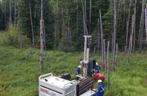
A topographic survey focuses on the natural and man-made features of a property. This includes elevations, contours, trees, streams, fences, buildings, and other visible structures. Engineers and architects often rely on this data for design and planning. For example, before constructing a new home or commercial building, designers use topographic details to determine drainage, grading, and how structures will fit into the landscape.
Topographic surveys are also valuable for projects like road construction, utility design, and landscaping. By mapping elevations and contours, they help professionals understand how water flows across the land, which is critical for preventing flooding or erosion problems in the future.
What Is a Boundary Survey?
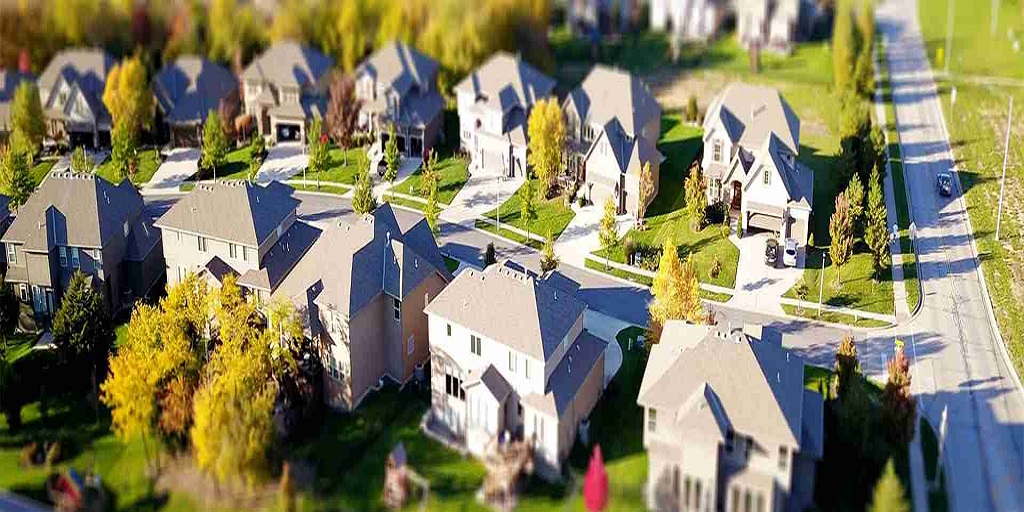
In contrast, a boundary survey defines the exact legal limits of a property. Surveyors use historical records, deeds, and physical markers to determine where one property ends and another begins. For landowners, this is especially important in areas where fences or landscaping features may not align with legal property lines.
Boundary Surveys in Edmonton are often requested during real estate transactions, property disputes, or before starting construction close to a property line. Having an accurate boundary survey protects owners from potential conflicts with neighbours and ensures that any new construction or improvements stay within legal limits.
Why the Distinction Matters
Although both surveys involve careful measurement and professional expertise, the information they deliver is different. A topographic survey tells you what is on the land and how the terrain behaves, while a boundary survey tells you where the property legally begins and ends.
Imagine planning a new garage. A topographic survey might reveal how the slope of the land will impact the foundation, while a boundary survey ensures the garage won’t extend into your neighbour’s lot. Without both pieces of information, the project could face serious setbacks.
Common Scenarios for Each Survey
- Topographic Surveys:
- Designing new subdivisions or roadways.
- Planning drainage systems or stormwater management.
- Landscaping projects requiring grading.
- Construction that depends on elevation changes.
- Boundary Surveys:
- Buying or selling property.
- Resolving disputes with neighbours over fences, driveways, or shared spaces.
- Building additions near the property line.
- Securing financing or permits that require proof of legal boundaries.
Choosing the Right Survey for Your Needs
The choice between a topographic survey and a boundary survey depends on the purpose of the project. Property owners should consider their goals: Is the concern about how the land looks and functions, or is it about where the legal limits are located? In some cases, both surveys may be necessary, particularly for larger developments or construction projects that require precise design and legal certainty.
Boundary Surveys in Edmonton are especially valuable in urban areas, where space is limited and disputes can arise more easily. Even in rural or suburban regions, boundary surveys help avoid costly mistakes, such as building on the wrong side of a property line or misinterpreting where easements apply.
For More Information About Professional Land Surveying Services Saskatchewan and Professional Land Surveying Services Regina Please Visit: Core Geomatics.