Topographic surveys play a critical role in planning construction, landscaping, and land development projects. They offer comprehensive data about a property’s natural terrain and built features, such as elevation changes, contour lines, utilities, and existing structures. A frequent concern, however, is how long this information remains reliable and when it becomes necessary to commission an updated survey. For those working in Edmonton, having clarity on this issue is essential to maintain precision, meet regulatory requirements, and support safe project execution.
What a Topographic Survey Covers
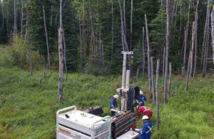
A topographic survey captures the three-dimensional characteristics of a piece of land. This includes both natural features, such as hills, valleys, rivers, and trees, and human-made features, such as buildings, fences, roads, and utility lines. Surveyors use precise instruments to measure elevation changes and distances, creating maps that are invaluable for architects, engineers, and developers. Topographic surveys in Edmonton are widely used in urban and rural areas to assist with everything from residential construction to large infrastructure projects.
The Typical Validity of a Topographic Survey
There isn’t a fixed expiration date for a topographic survey, as its relevance largely depends on the rate of change in the surveyed area. In general, a survey can remain accurate for several years if the land is stable and there are no major developments or environmental changes. Many professionals consider surveys valid for about 2 to 5 years, though this can vary depending on local conditions, such as soil movement, flooding, or construction activity. In areas experiencing rapid development, shorter validity periods are often recommended to maintain precision.
Factors That Can Require an Update
Several factors may render a topographic survey outdated. Changes in land use, new construction, road expansions, or additions of utility lines can all impact the accuracy of previous measurements. Additionally, natural events such as heavy rainfall, erosion, or frost heave can alter ground levels, particularly in areas with variable terrain. For Edmonton, where seasonal changes can be significant, even minor elevation shifts can have a major effect on survey data. Therefore, it’s important to consider updating a survey before beginning any major project.
Indicators That a Survey Should Be Redone
Recognizing the signs that a topographic survey needs updating is key. If there have been noticeable changes to the landscape or property since the last survey, it’s time to schedule a new one. For example, if a nearby development has altered drainage patterns, or if new structures have been built close to the property line, previous survey data may no longer be reliable. Additionally, if a survey is over five years old, it is generally recommended to commission an updated version to ensure that any planning or construction decisions are based on the most accurate information.
Scheduling a New Topographic Survey
While some surveys can last several years, the safest approach is to assess the site’s conditions regularly. Projects that involve substantial earthworks, new infrastructure, or changes to drainage patterns should almost always be preceded by an updated topographic survey. Engaging a qualified surveyor ensures the survey reflects current conditions, providing reliable data for architects, engineers, and contractors.
By understanding the factors that affect the validity of a topographic survey, property owners and developers in Edmonton can make informed decisions and avoid costly surprises. Topographic surveys are not just maps; they are precise tools that, when current, guide the success of any project. Keeping them up to date is an investment in accuracy, safety, and efficiency.
For More Information About Survey Services Regina and Land Survey Services Saskatchewan Please Visit: Connexa Group.