Property ownership involves more than holding a title—it requires clearly defined and legally recognized boundaries. Cadastral surveys play a crucial role in establishing these boundaries with precision and authority. Their legal strength comes from regulated practices, standardized methods, and official recognition by land registry systems. Understanding why these surveys are legally binding helps explain their importance in property ownership, development, and dispute resolution.
The Legal Purpose of a Cadastral Survey
A cadastral survey is designed to formally define property boundaries based on legal descriptions rather than assumptions or informal measurements. Surveyors examine historical records, registered plans, and existing boundary markers to determine the exact limits of a parcel of land. This process ensures that the physical layout of a property aligns with the legal intent recorded in land titles.
Because cadastral surveys are tied directly to ownership rights, they are treated as legal instruments. Their purpose is not simply informational but evidentiary, meaning they can be relied upon in legal and administrative decisions.
Licensed Professionals and Regulatory Oversight
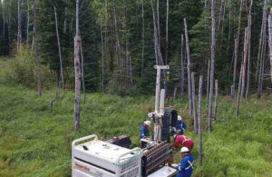
One of the main reasons cadastral surveys are legally binding is that they are prepared by licensed land surveyors. These professionals are required to meet strict education, training, and ethical standards before they are authorized to practice. Their work is subject to oversight by regulatory bodies, which helps maintain consistency and accuracy across the industry.
If a surveyor fails to follow professional standards, there can be legal and disciplinary consequences. This level of accountability gives courts, landowners, and institutions confidence in the reliability of cadastral survey results.
Standardized Methods and Official Documentation
Cadastral surveys follow standardized procedures that are recognized by land registry offices and governing authorities. Surveyors verify boundary evidence, assess potential encroachments, and document findings in a formal survey plan. Once completed, these plans are registered and become part of the permanent public land record.
Registration ensures that the survey carries long-term legal weight. Future property transactions, developments, or disputes can reference the same registered document, reducing ambiguity and inconsistency over time.
Role in Urban Development and Land Use
In expanding urban areas, boundary clarity is essential. Cadastral surveys in Edmonton are commonly required before construction, subdivision, or rezoning projects move forward. Accurate boundary information helps prevent conflicts between neighbouring landowners and ensures compliance with planning requirements.
By clearly defining property limits before development begins, cadastral surveys help avoid costly delays, redesigns, and legal challenges later in the process.
Use in Legal Disputes and Conflict Resolution
When boundary disputes arise, cadastral surveys provide objective and legally recognized evidence. Issues involving fences, access rights, easements, or encroachments often rely on registered survey plans for resolution. Courts and arbitrators favor these documents because they are created under strict legal and professional standards.
Their neutrality and precision make cadastral surveys a reliable reference point when property rights are contested.
Protection for Buyers, Sellers, and Lenders
Cadastral surveys offer protection to all parties involved in property transactions. Buyers gain confidence that the land they are purchasing matches the legal description, while sellers reduce the risk of post-sale disputes. Financial institutions also rely on these surveys to assess risk before approving financing.
Cadastral surveys in Edmonton continue to serve as a foundation for secure property ownership, regulatory compliance, and dispute prevention. Their legal authority is built on professional accountability, standardized practices, and formal registration—making them indispensable in property matters where accuracy and clarity are essential.
For More Information About Professional Land Surveying Services Regina and Residential Land Survey Saskatchewan Please Visit: Core Geomatics.