Digital transformation continues to reshape land administration systems across the country. Provincial land registries have steadily modernized over the past decade, shifting from paper-based records to integrated online platforms. With further digital title enhancements expected after 2026, surveyors are proactively refining their tools, workflows, and expertise to keep pace. These advancements are set to influence how property boundaries are verified, registered, and maintained—making expert land surveying services more important than ever.
The Shift Toward Fully Integrated Digital Land Titles
Land title systems have already embraced electronic registration and digital document storage. The next phase is expected to focus on deeper system integration, real-time data validation, enhanced geospatial mapping layers, and improved cybersecurity safeguards.
Surveyors understand that digital title upgrades will require even greater accuracy and consistency in submitted plans. As registry systems become more automated, discrepancies between survey data and digital mapping frameworks may be flagged instantly. That means survey documentation must meet higher technical standards from the outset.
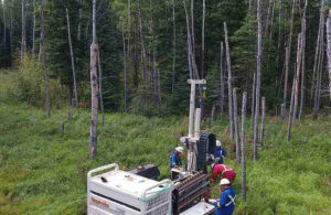
Expert land surveying services are adapting by investing in advanced geographic information systems (GIS), global navigation satellite systems (GNSS), and 3D mapping technologies. These tools support more precise measurements and seamless compatibility with digital registry platforms.
Strengthening Data Accuracy and Compliance
Accuracy has always been central to land surveying. With upcoming digital enhancements, precision will become even more critical. Digital title platforms increasingly rely on standardized data formats and automated cross-checking tools. Small inconsistencies that might have once required manual review could now delay approvals or registrations.
To prepare, surveyors are refining internal quality control processes. This includes double-verification of boundary calculations, improved calibration of equipment, and ongoing professional development in emerging regulatory requirements.
In many provinces, continuing education programs now emphasize digital submission protocols and cybersecurity awareness. Expert land surveying services are ensuring their teams remain current with these evolving standards to reduce processing times and maintain compliance with registry requirements.
Embracing Automation Without Losing Professional Judgment
Automation is expected to play a larger role in title management after 2026. Artificial intelligence and machine-assisted validation tools may assist registries in identifying boundary overlaps, historical inconsistencies, or incomplete documentation.
Despite these advancements, professional judgment remains indispensable. Land surveying is not simply a technical exercise; it requires interpretation of historical plans, legal descriptions, and physical evidence on the ground.
Surveyors are preparing by combining technological efficiency with deep professional expertise. While digital tools can highlight anomalies, trained professionals determine how to resolve them appropriately. Expert land surveying services bridge this gap by integrating advanced software with experienced oversight.
Enhancing Cybersecurity and Data Protection
As land title systems become increasingly digital, cybersecurity risks also grow. Property records represent high-value data, making them attractive targets for fraud or unauthorized access.
Surveying firms are responding by strengthening internal data protection measures. Secure cloud storage, encrypted file transfers, and multi-factor authentication are becoming standard practice. Additionally, firms are reviewing their data retention policies to ensure compliance with privacy regulations.
By prioritizing cybersecurity readiness, expert land surveying services help protect both property owners and the integrity of the broader land registration system.
As digital title platforms continue to evolve, the role of expert land surveying services will remain central to maintaining confidence in property boundaries and land ownership records. Through careful preparation and a commitment to precision, surveyors are positioning themselves to meet the demands of the next generation of land administration systems.
For More Information About Land Surveying Regina and Residential Land Survey Saskatoon Please Visit: Connexa Group.